Natural Heritage and History
Donate to Scolty Tower
Donations of any size are warmly welcomed to help preserve the tower for future generations.

Historical Landscape
Scolty Hill is one of the most easterly hills in the Cairngorms, forming part of the Grampian Massif. It can also be considered a northern part of the Mounth, a broad stretch of upland hills running between the highland boundary fault and the River Dee, which for centuries served as both a physical and cultural divide between the north and south.
Historically, black cattle were raised north of the Mounth, then driven across these hills along ancient droving routes such as the Cairn o’ Mount road to reach markets in Perthshire and the farther south. Cattle and sheep would have grazed the hills around Scolty for many centuries, a practice which continues to this day.
Wildlife and habitats
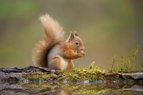
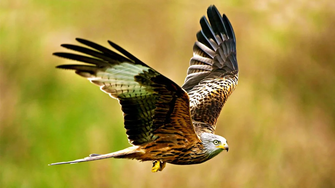
Scolty Hill and the surrounding woodland area are home to a rich variety of wildlife, with the chance to spot red squirrels, roe deer, pine martins, badgers, foxes, buzzards, red kites, goshawks, jays, lizards and much more. The streams and pools are often filled with frogspawn and tadpoles in the spring.
Trees on Scolty are mostly birch, rowan, larch and Scot’s pine, with gorse, broom, heather and blaeberry as ground cover. Bell heather thrives on the drier slopes, while bog asphodel and the rarer grass of Parnassus can be found in wetter areas.
Geology
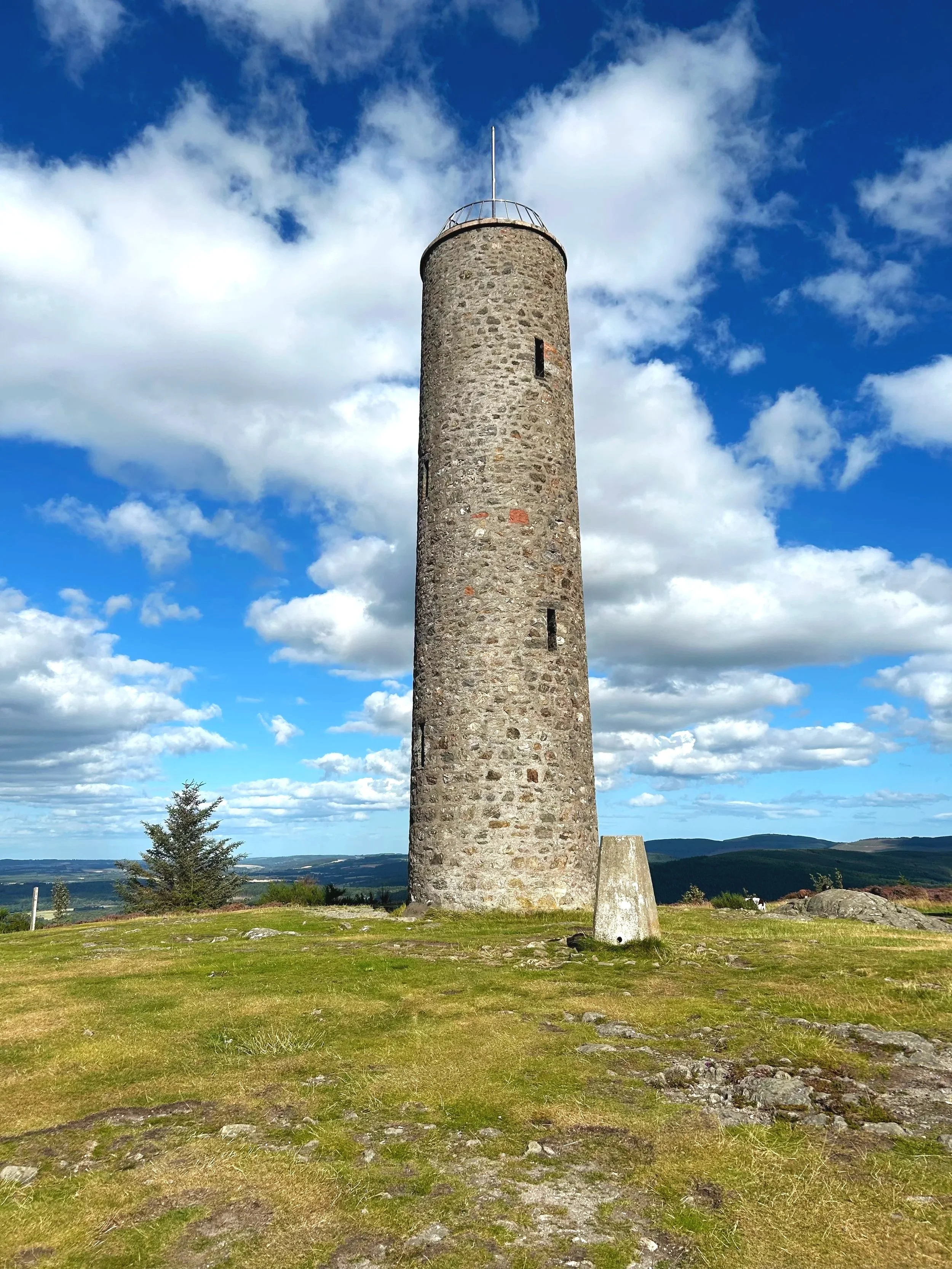
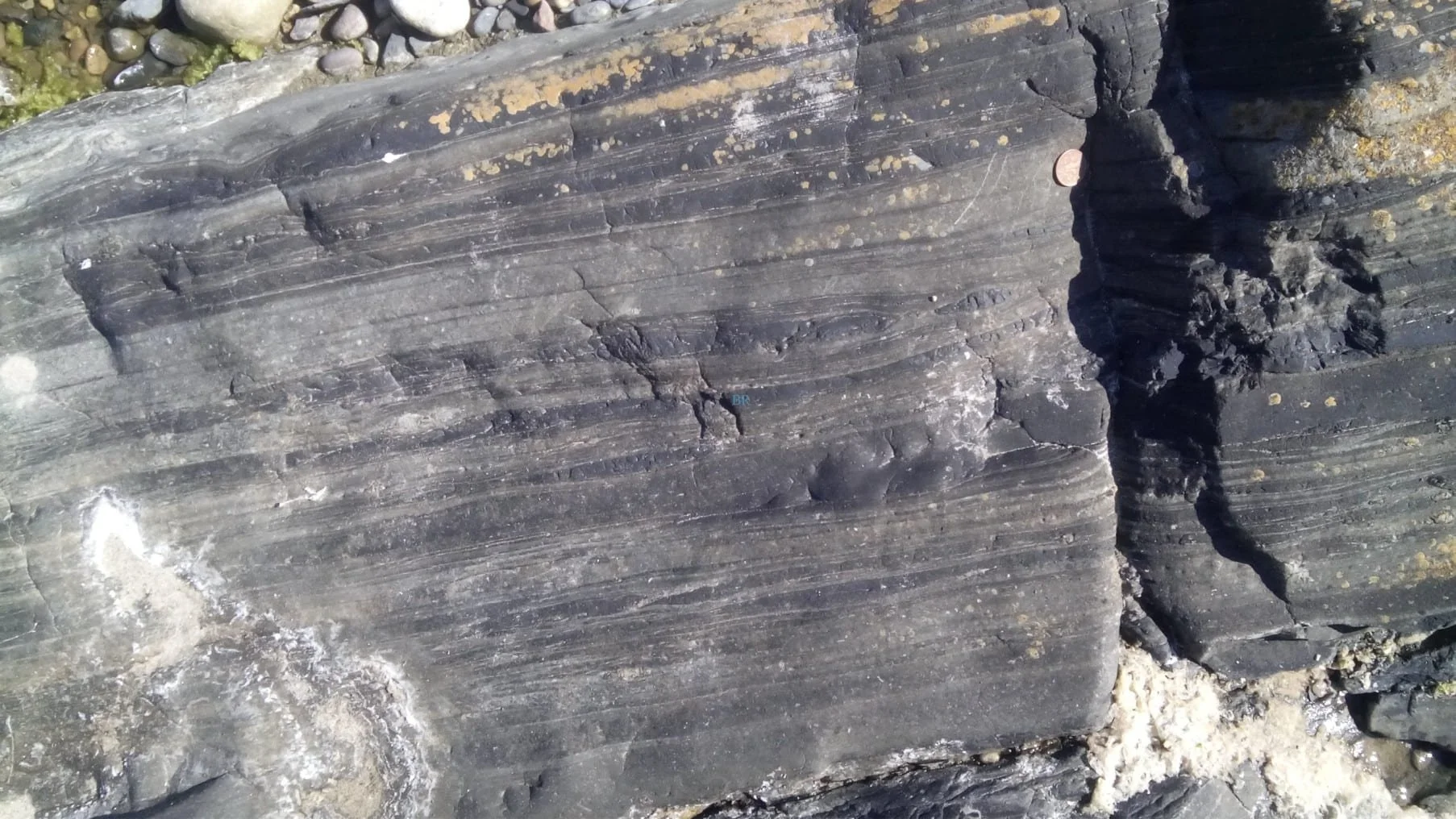
Scolty Hill is formed of metamorphosed Dalradian gneiss, rocks that were subjected to extreme heat, pressure, and deformation deep within the Earth, giving them their characteristic banded appearance.
These rocks can be found at the top of Scolty Hill, with the best examples along the path from the summit to the east.
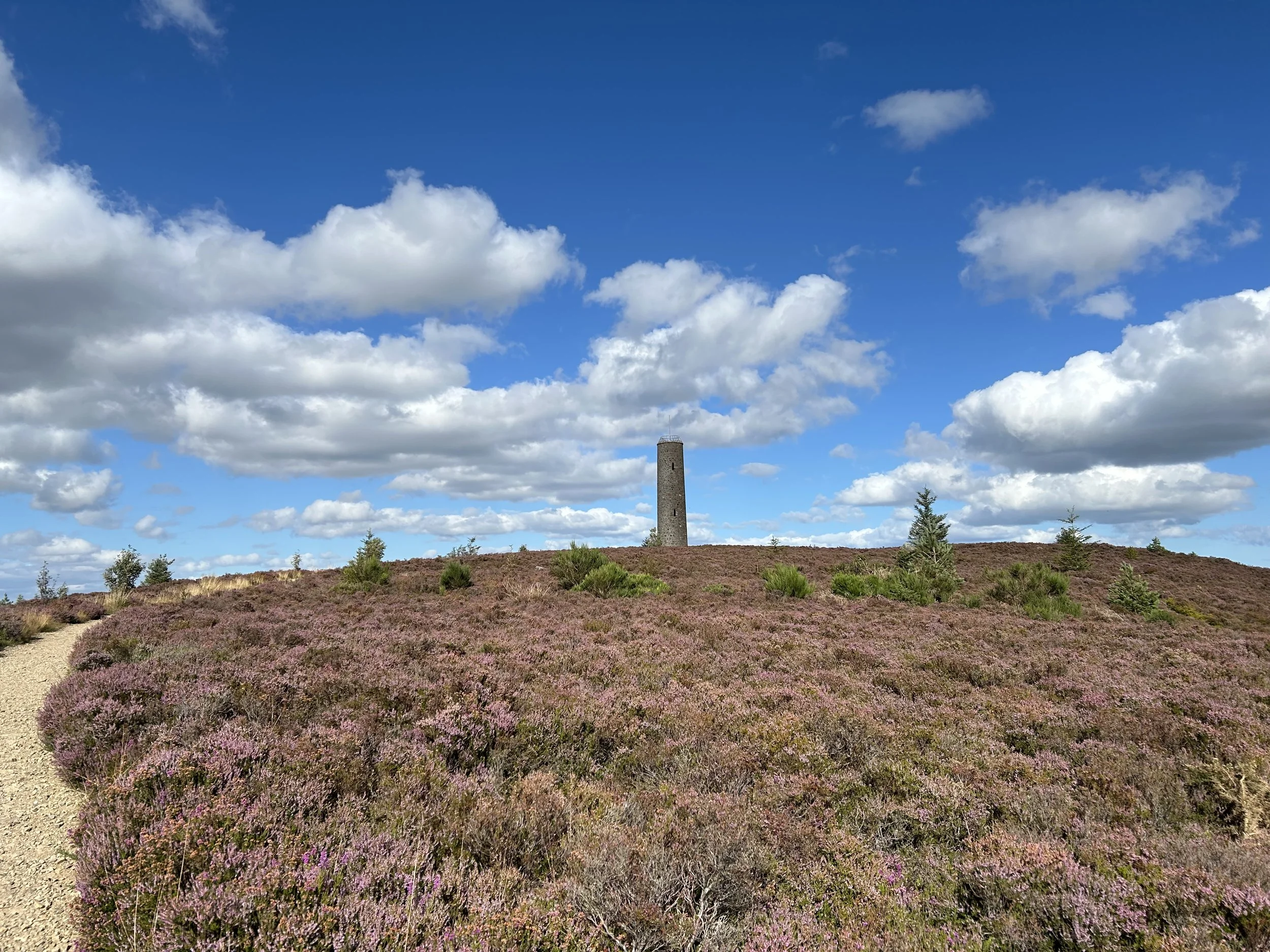
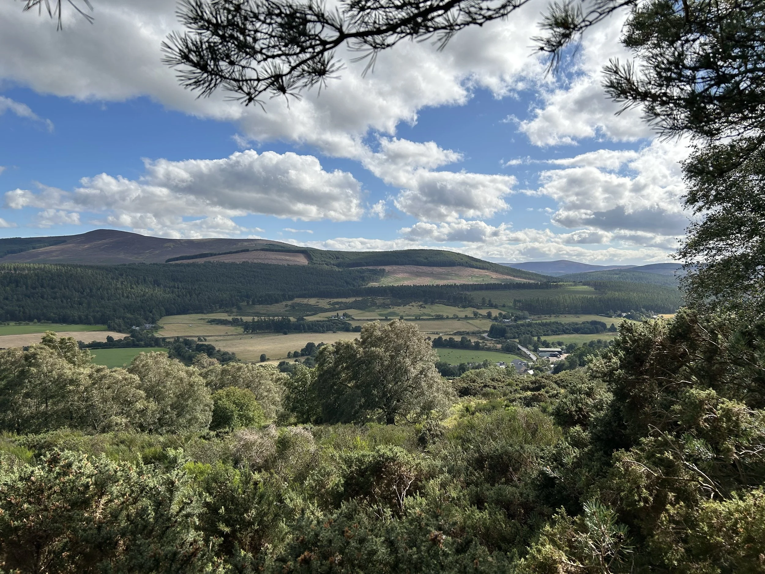
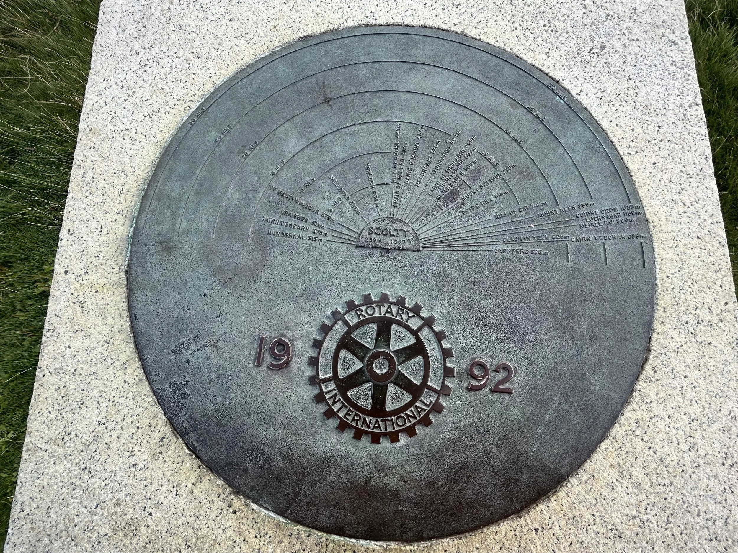
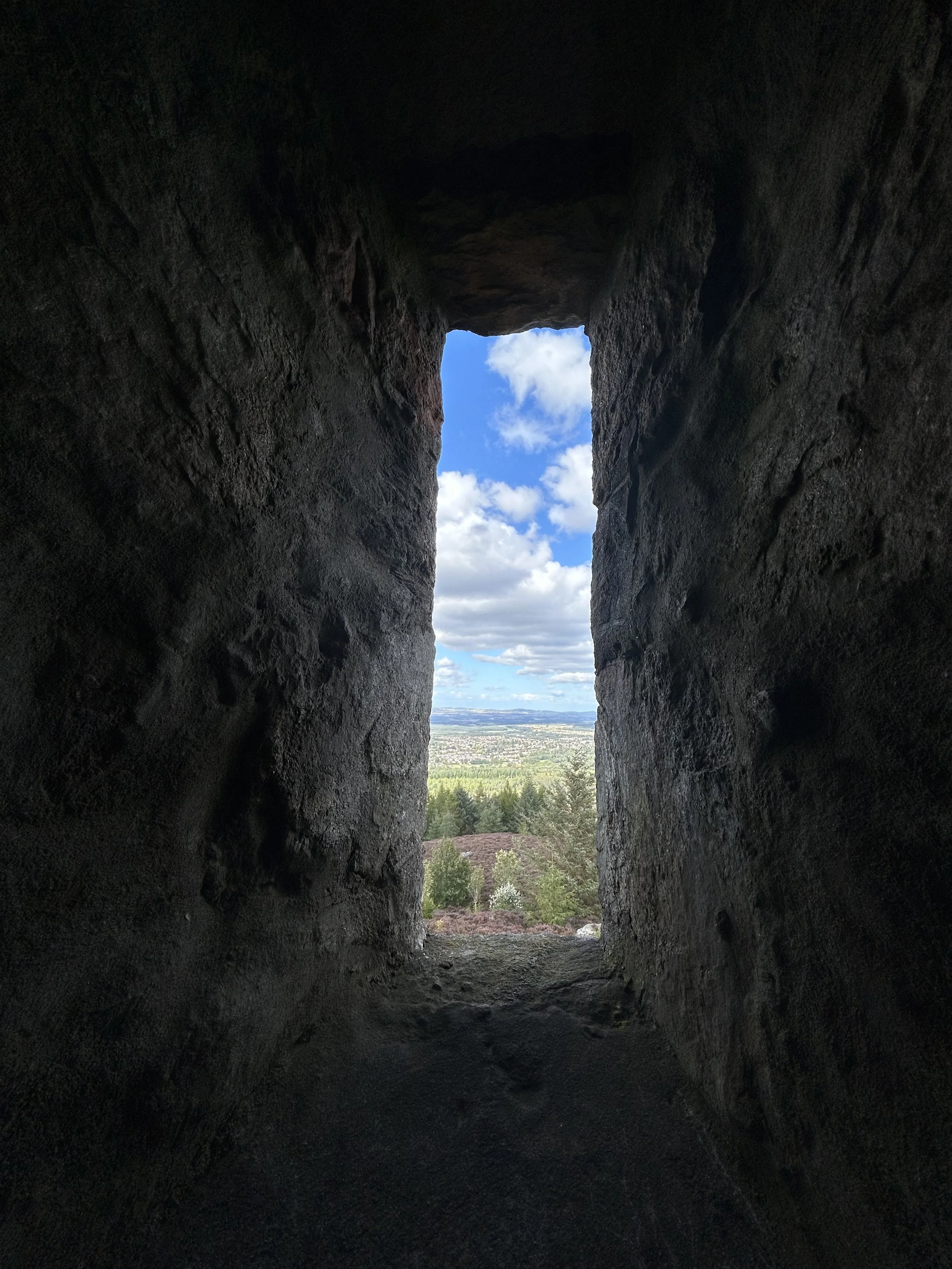
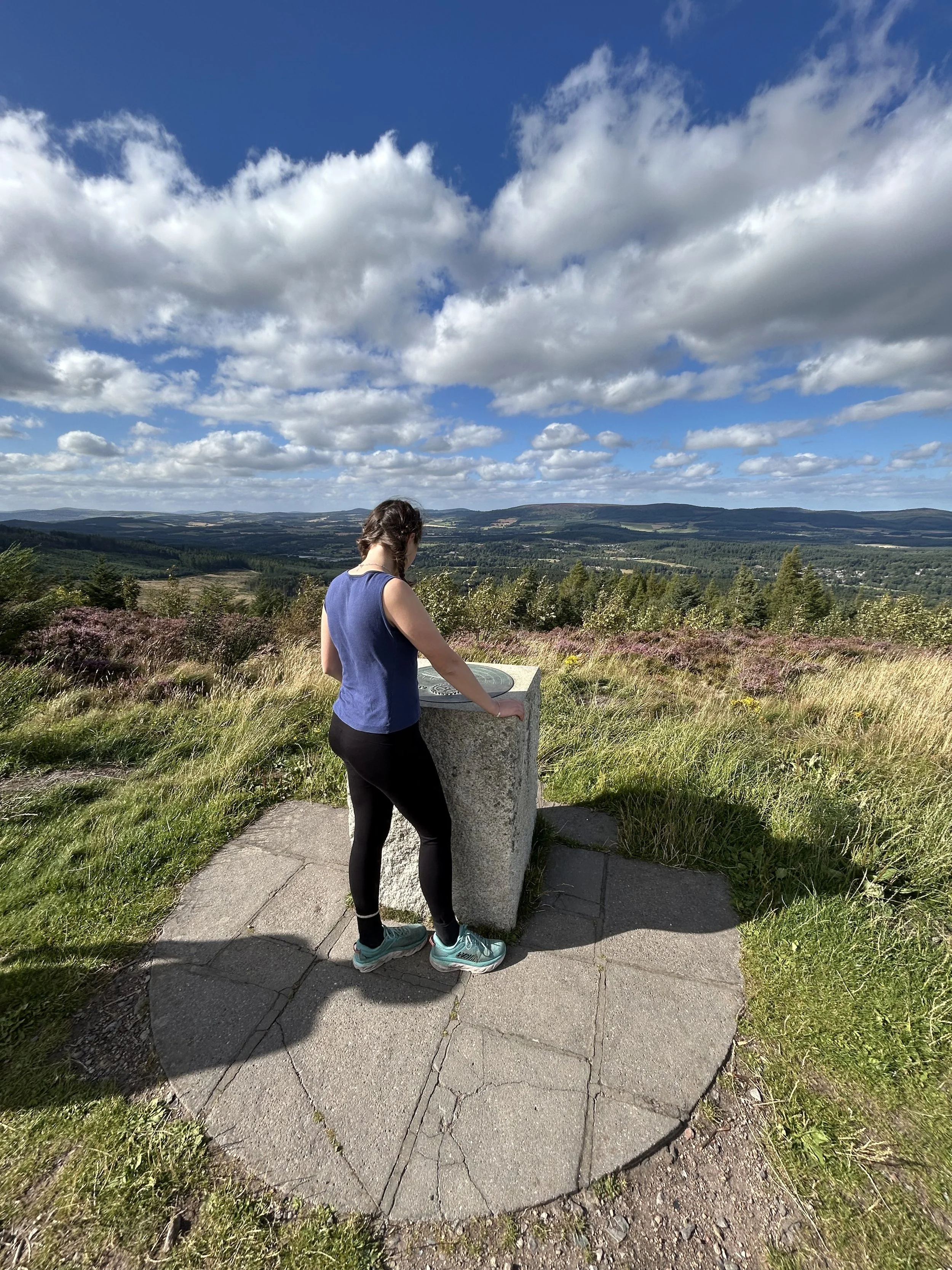
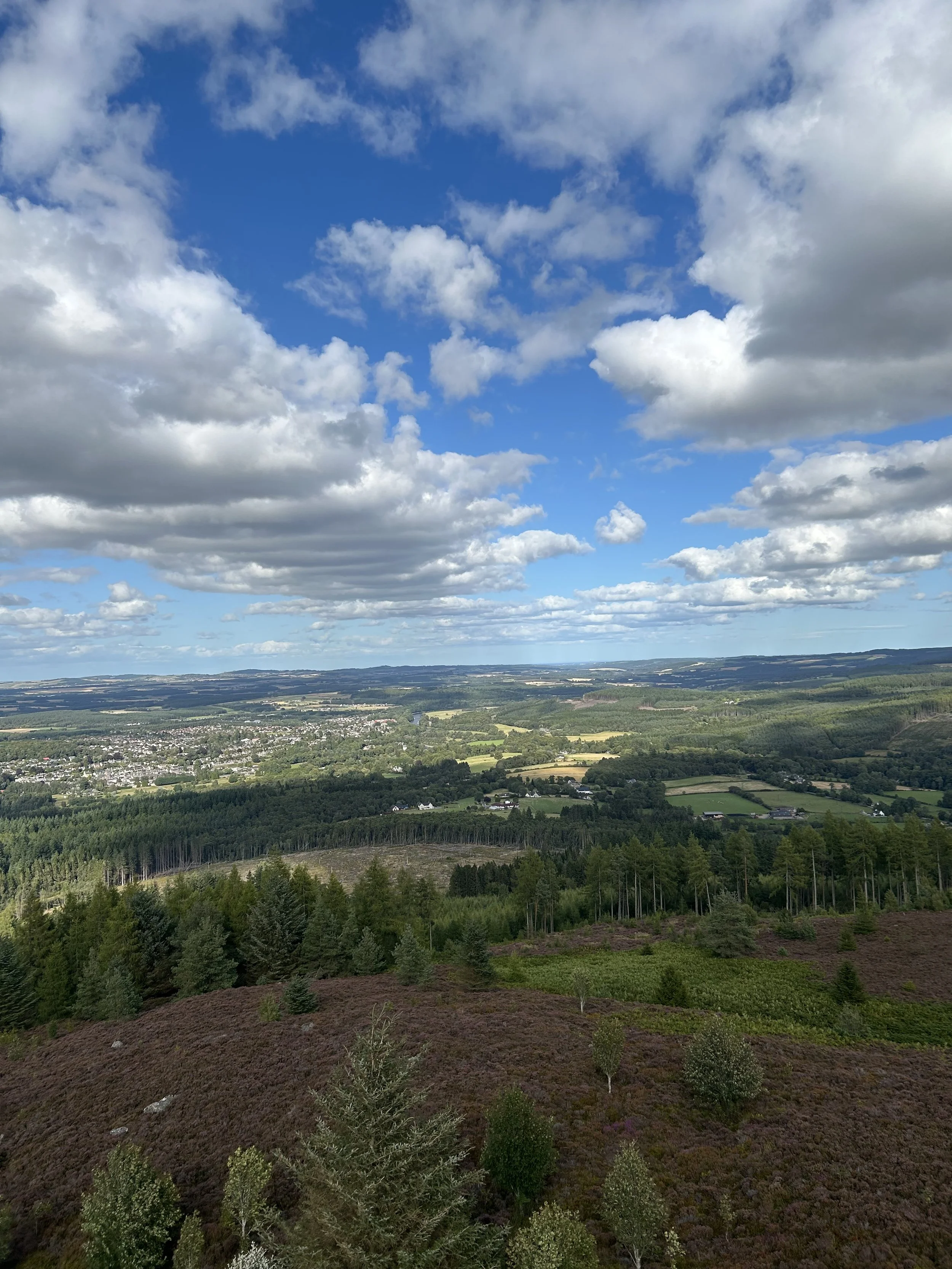
Views from the Summit
From the top of Scolty Tower, sweeping panoramic views unfold in every direction. Below, the town of Banchory lies nestled beside the River Dee, with Crathes Castle, the ancestral home of General Burnet, peeping through the trees to the east.
To the south, the Water of Feugh winds its way past the village of Strachan, with the Cairn o’ Mount road climbing beyond the valley into the rolling hills of the Mounth. Among them, the distinctive outline of Clachnaben, crowned by its granite tor, marks the skyline as the hills stretch westward towards the Cairngorm National Park.
To the north, in the distance, the peaks of Bennachie and Tap o’ North can be spotted, the latter home to a famous Pictish hillfort. Two compass indicator points can be found beside Scolty Tower, with arrows helping identify surrounding landmarks.
Scolty Through the Ages
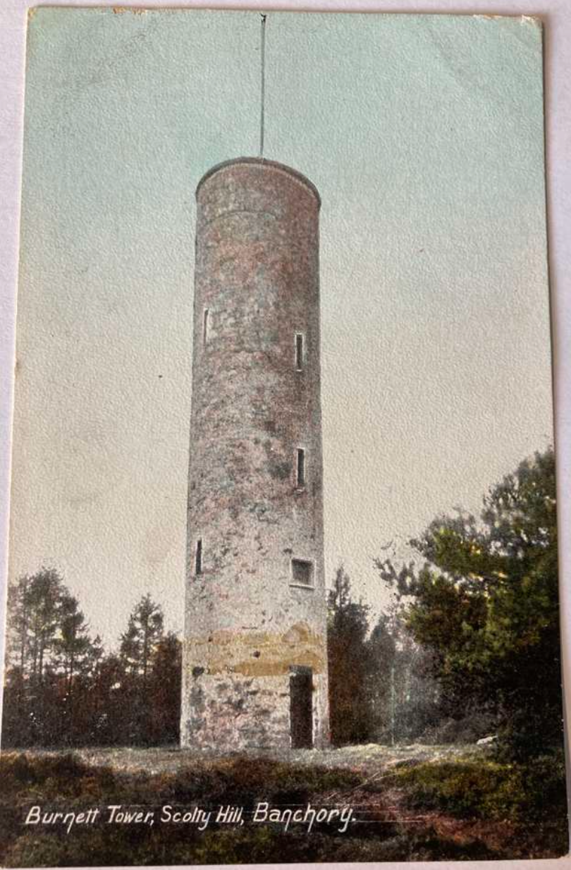
Historical photos of Scolty Tower and hill from the late 1800’s and early 1900’s
Scolty Tower post cards, from around 1870:
Scolty Hill and Tower from the 1910s:
Photo property of Port of Aberdeen
Photo property of Port of Aberdeen
Photo property of Aberdeen City and Aberdeenshire Archives
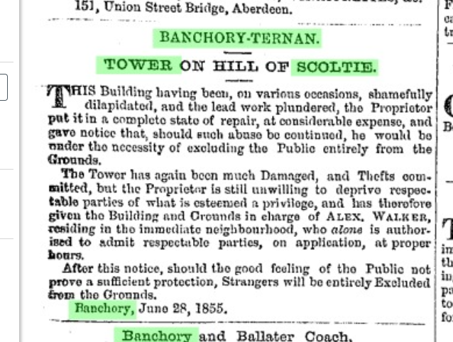
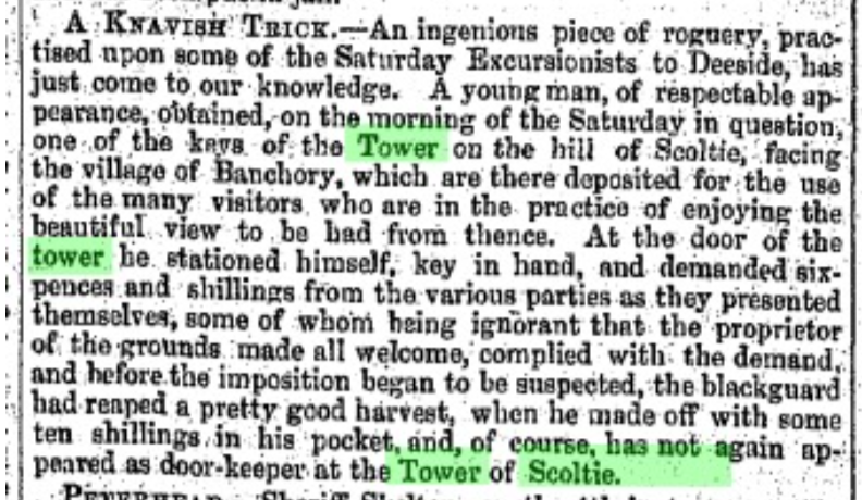
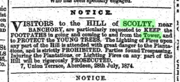
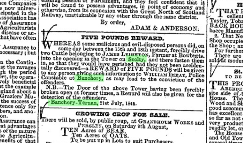
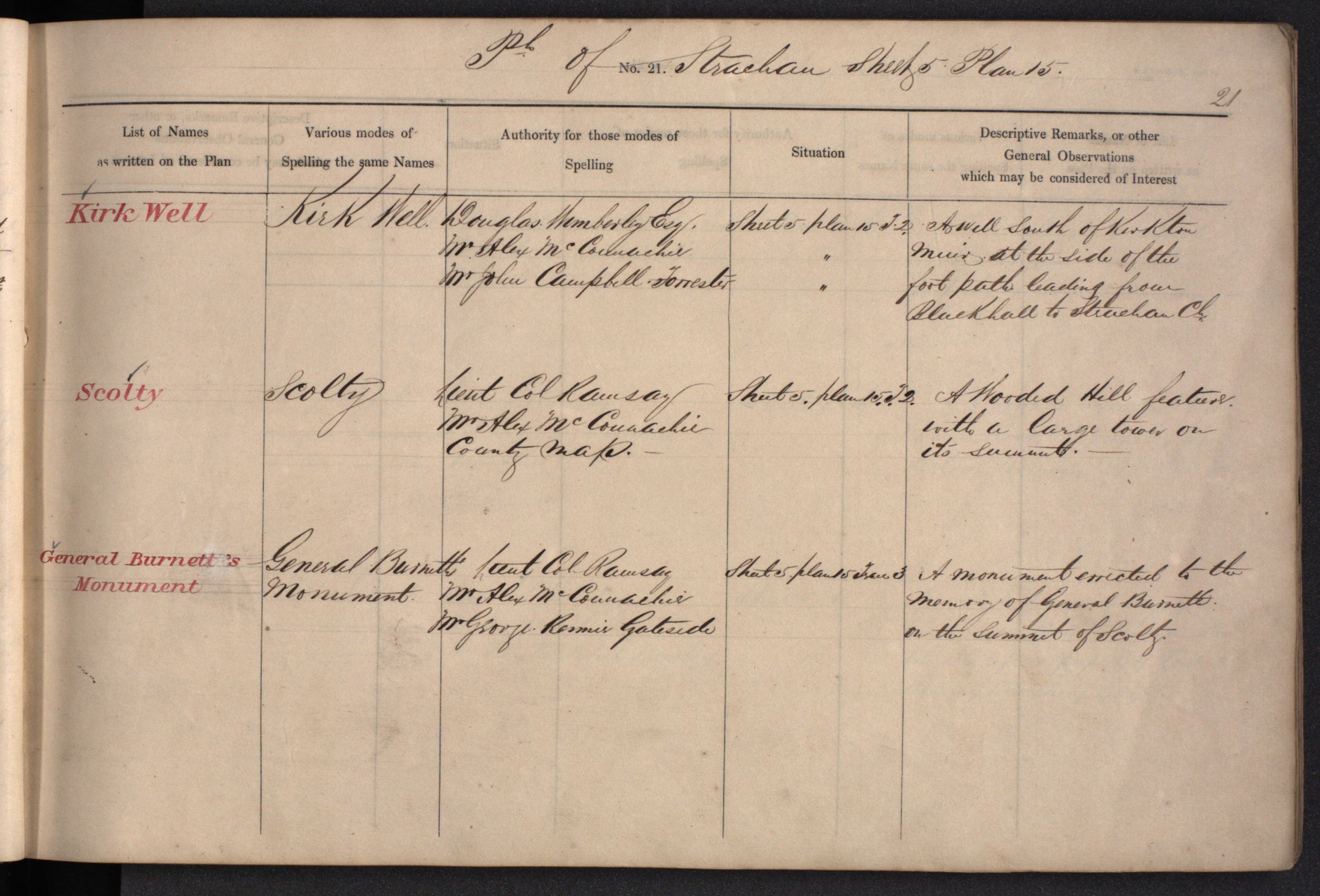
Historical newspaper articles from the mid to late 1800’s featuring Scolty Tower, and Strachan parish book from 1863:
Click to enlarge.