Explore Feughside
Discover miles of scenic walking and cycling routes, rich local history, and fascinating geology shaped over millions of years.
View the interactive Aberdeen map here for paths, amenities, services and more:
https://gis.aberdeenshire.gov.uk/maps/
Jump to: History, Geology, Important Landscapes and Ecosystems
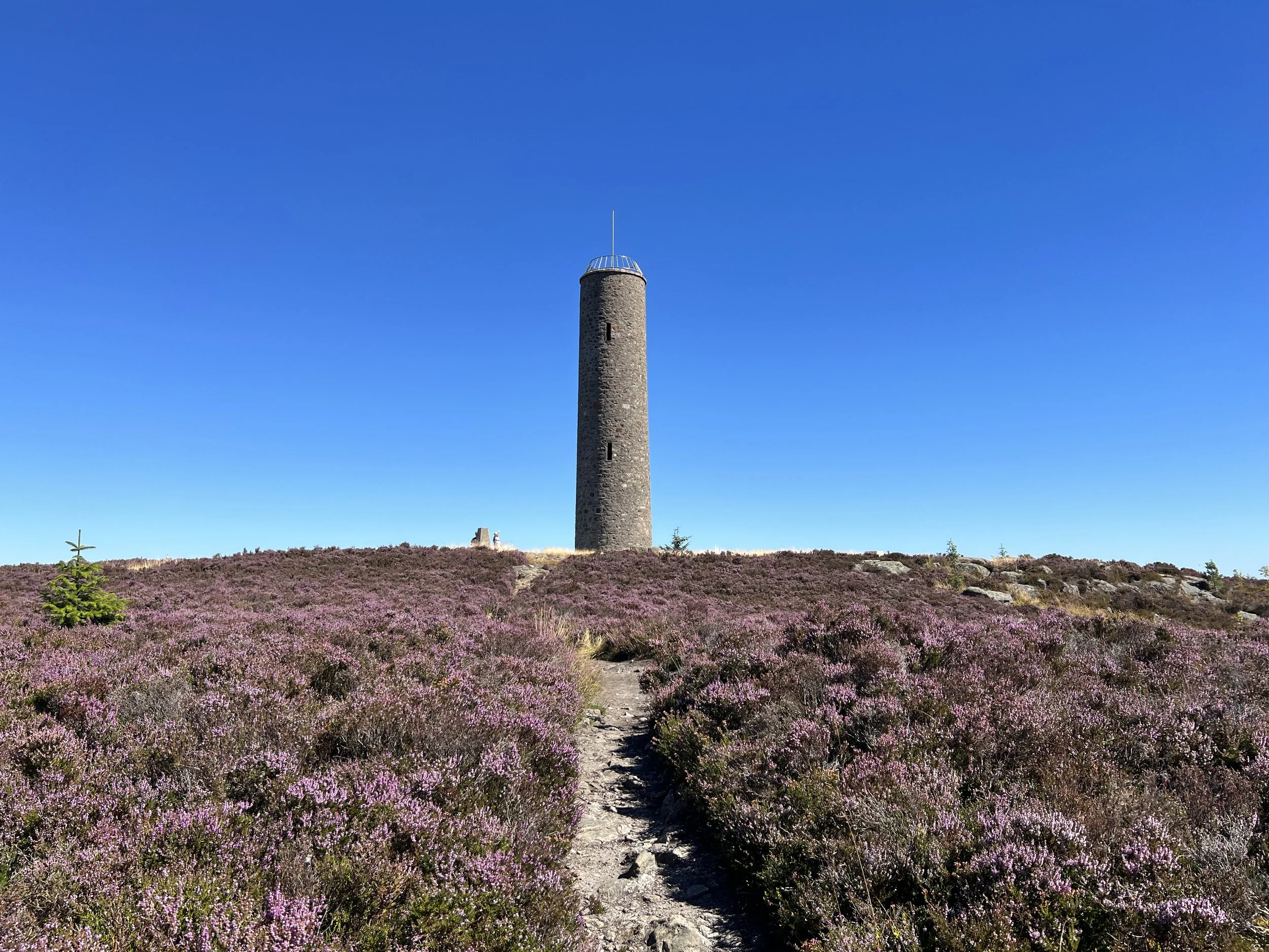
Discover Scolty Hill and Tower
Scolty Hill, just south of Banchory, is a popular spot for walkers, with scenic woodland trails leading to the summit. From the top, visitors can enjoy panoramic views across Deeside and the historic Scolty Tower.
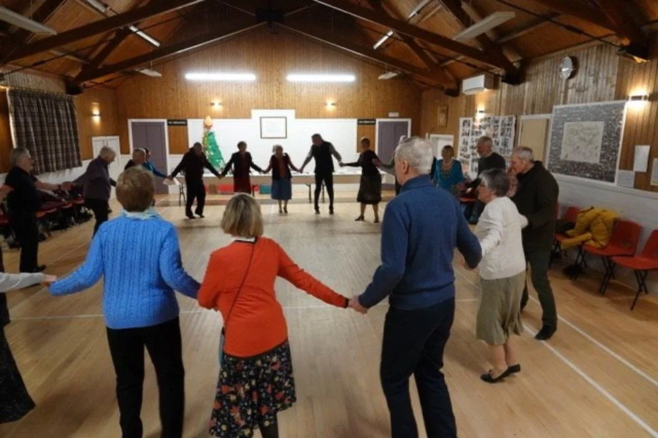
Strachan Hall
Strachan Village Hall is a lively hub at the heart of the community. Come along to a class, club, or local event and be part of village life.
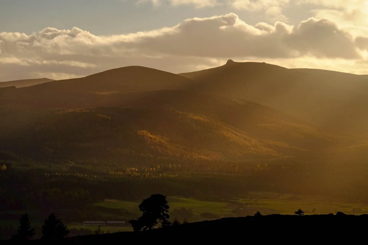
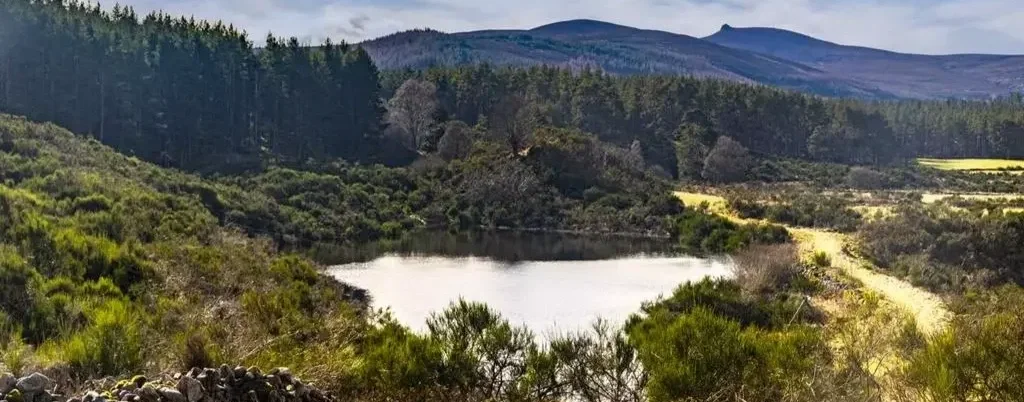
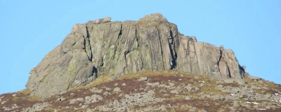
Walk up Clachnaben
Clachnaben, which defines the Feughside skyline, is an iconic 589m hill in Glen Dye, crowned by a striking granite tor. A small carpark is located at the foot of the hill.
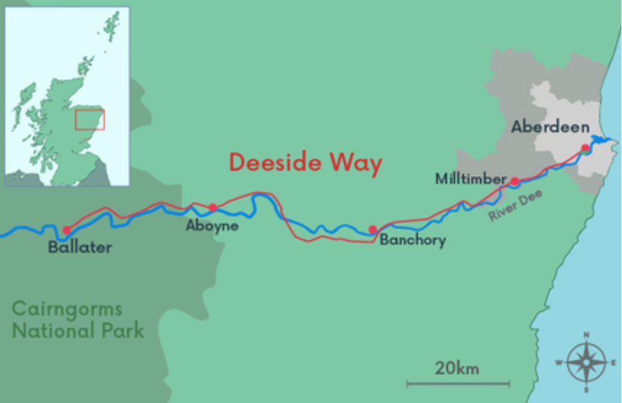
The Deeside Way
A 65 km long route, from Aberdeen to Ballater, which runs through Feughside. The path is suitable for walkers and cyclists with many sections suitable for horses. It is Route 195 of the National Cycle Network, co-ordinated and promoted by Sustrans.
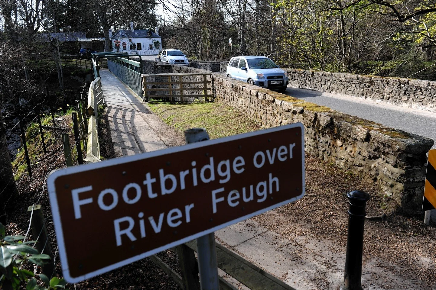
Bridge of Feugh
Admire the waterfall from the footbridge, or come in autumn to see salmon leaping through the rushing water as they make their way upstream.
Explore paths and trails in Craig of Dalfro
View the network of paths at Craig of Dalfro by clicking on the image below. Trails are marked to indicate whether they are suitable for walking, mountain biking or horse riding. The area can be accessed from Bogendriep and Galley Bank.
History
Glendye’s Lost Communities
Learn about the lost communities of Glendye - Spittleburn, Fingleny and Garr - the ruins of which can still be visited today.
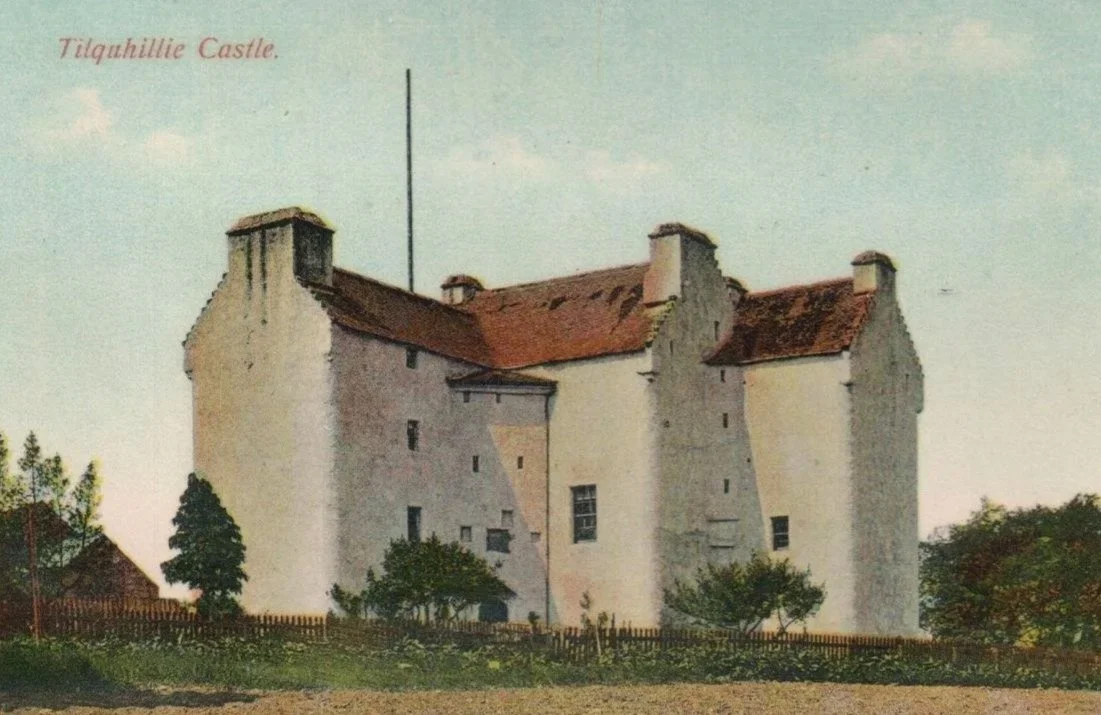
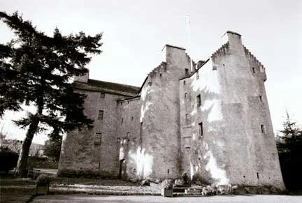
Tilquhillie Castle
Tilquhillie Castle, a category A listed building, is a well-preserved Z plan Tower house, said to have been built by John Douglas in 1576, on an area once part of the lands of Arbroath Abbey.
Stone circles
Three ancient stone circles lie within Feughside. The largest, the Nine Stanes Recumbent Circle, rests in a peaceful woodland clearing just 100 metres from the Mulloch Wood car park. Nearby, Eslie the Greater and Eslie the Lesser stand about half a mile apart, set in open farmland within sight of each other.
Articles on the and topography, natural history and population of the parishes of Strachan and Banchory written in 1842 by Rev. David Scott Fergusson:
Historical Photos of Strachan
Click to enlarge
Photo credited to Ness Morrison
Photo credited to Ness Morrison
Martha Grant, Local Figure and Unofficial Postie
Martha Grant, pictured here, played a vital role in the daily life of Feughside. She transported provisions, parcels and letters by wheelbarrow from the train station in Banchory to Strachan, making the journey three times a week in each direction. She continued this essential service until the 1860s. Martha died in 1880 at the age of 87.
Geology
Much of the beautiful natural environment of Feughside is the result of equally spectacular underlying geology. Ancient bedrock and more recent glacial activity provide a significant range of interesting, and even unique, geological features.
Local Nature Conservation Site
Feughside contains a large area designated, due to its geomorphological interest, as a Local Nature Conservation Site in the Aberdeenshire Local Development Plan. The site represents the best part of a more extensive fluvioglacial complex and encompasses Clachnaben, which contains a good example of a granite tor.
Explore locations of Feughside’s geological features:
Glacial Geology of Feughside
Feughside is home to some striking glacial landscapes. These formed around 10,000–11,000 years ago, at the very end of the last Ice Age, during a period known as the Loch Lomond Stadial.
Former glaciers started to recede, releasing vast amounts of meltwater. Sub-glacial rivers formed sinuous sand and gravel deposits called Eskers. Peri-glacial lakes were formed around the glaciers, dammed in by residual ice. These lakes were then filled in by clay, sand and gravel deposits, carried by the meltwater. Remnant ice blocks got caught in these deposits and, when they melted, formed kettle holes and lakes. Numerous meltwater channels were cut in bedrock as huge amounts of water escaped over cols between valleys, and under the ice itself.
The peri-glacial lakes are a particularly interesting feature of Feughside and have been studied and described in detail. The British Geological Survey (BGS) has stated Feughside contains “A most impressive kettled terrace (the Pitdelphin Wood Terrace), which stands up to 30m above the level of the floodplain of the Water of Dye, and that occurs between Pitdelphin Farm and Bogarn.”
Solid Bedrock Geology
The nearly one-billion-year-old geological history of the area has produced some of the most intensely deformed, “metamorphosed,” and melted rocks in Scotland. These metamorphic rocks were then intruded by various igneous (molten) rocks, such as granite. The geology has radically shaped the landscape and helped to make the area picturesque. Many key natural landmarks have geologic origins. Hills such as Clachnaben and Kerloch form part of the Mount Battock granite intrusion in the south of the area. Hills in the north, such as Scolty Hill and Tom’s Cairn, are formed of metamorphosed Dalradian gneiss. Bedrock is also exposed in streams and can easily be seen from local bridges at the Falls of Feugh (tilted and metamorphosed Dalradian gneiss) and the old Bridge of Bogendreip (granite). Local quarries also provide good outcrops.
These rocks have acted as a “tape recorder” of geological history. Documenting the breakup of the former supercontinent Rodinia, about 800-1000 million years ago, and the formation of another supercontinent, Pangea, in a massive continental collision that joined Scotland to England, just over 400 million years ago, and formed a Himalayan like mountain chain that has been eroding since then, with the very recent ice age continuing that process.
Important Landscapes and Ecosystems in Feughside
As well as the geological Local Nature Conservation Site, Feughside contains a number of areas and ecosystems classified as important in the 2023 Aberdeenhsire Local Development Plan.
Birse and Clachnaben Special Landscape Area
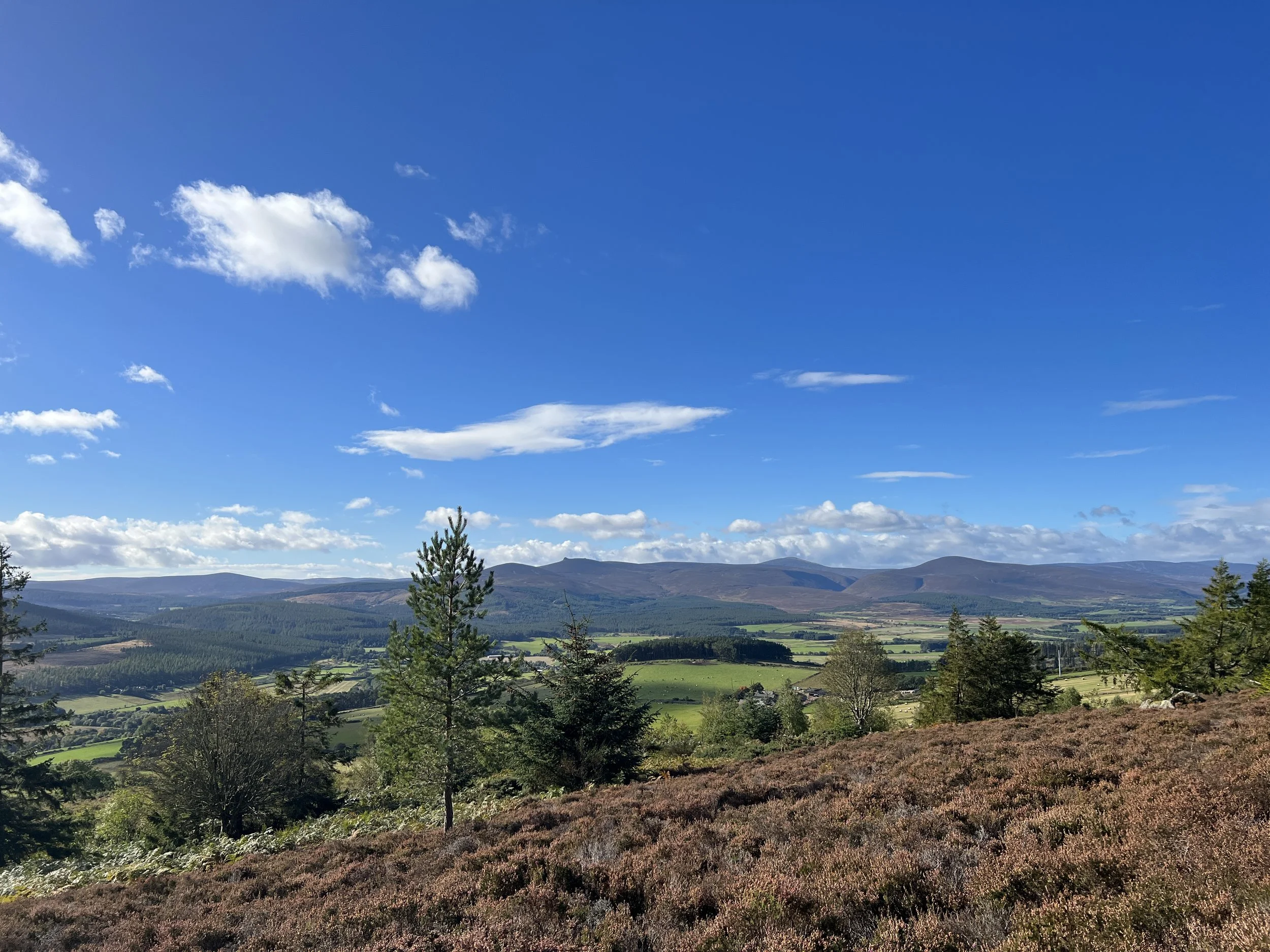
This area is valued for its rolling, rugged upland scenery, with Clachnaben a popular walking destination and iconic local landmark. The landscape is widely visible from the surrounding area and stretches seamlessly towards the Cairngorms National Park, forming some of the wildest countryside in Aberdeenshire.
River Dee Special Area of Conservation
The River Dee and all its tributaries, including the Feugh, Dye and Aven, is classified as a Special Area of Conservation due to internationally important populations of freshwater pearl mussels, Atlantic salmon and otters.
Carbon-Rich Soils
Feughside contains large areas of heathland and blanket bog, much of which is classified as nationally important carbon-rich soils (class 1, 2 and 5). Blanket bog is an important peatland ecosystem, providing crucial carbon storage and reducing flooding by regulating runoff from rain and snow.
Ancient Woodland
Feughside contains substantial areas of ancient woodland, including Plantations on Ancient Woodland Sites (PAWS), which contain important remnants of ancient woodland biodiversity.